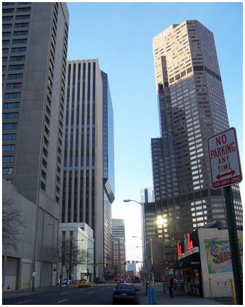
Denver
Denver, the capital and largest city of Colorado, USA, beautifully situated on the South Platte River at the crossing between the prairie and the Rocky Mountains. 600,200 residents, of which 32% are Spanish-speaking and 10% are black (2010). Nickname: The Mile High City (the city is located at an altitude of 1600 m).
The town grew up around gold discoveries in 1858 and after the construction of railways from around 1870 became the center of a large catchment area, based on supplies from prairie agriculture to the east (cattle, sheep, grain) and high-lying mineral deposits to the west (gold, silver and later oil). In the first half of 1900-t. the city became home to federal institutions and facilities, the US Mint coin factory, Fitzsimmons military hospital, and Lowry Air Force Base, which, along with the expansion of the road network, the construction of Stapleton International Airport, growing tourism, and new high-tech industries (especially aerospace industries) have contributed to the city’s rapid development.
Apart from enclaves with poor residential areas (Mexican immigrants and blacks), the urban area is characterized by modern high-rise buildings with hotels, offices and shops, while housing and industry are found in a wide, surrounding suburban zone. On the southern edge is the Denver Tech Center, which houses most of the city’s research-intensive businesses.
As a tourist destination, the city is attractive due to a pleasant, sunny climate and the proximity to some of the USA’s most famous ski resorts. The mountain areas are also popular excursion destinations in the summer. This applies, for example, to Red Rocks Park, whose rust-red rocks form the setting for outdoor concerts in a nature-created amphitheater with room for 10,000 spectators. 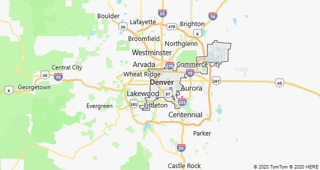
Aspen
Aspen, a city in Colorado, USA; 6658 residents (2010). It emerged as a mining town near large silver finds in 1879 and reached ten,000 residents ten years later, before falling ill due to low silver prices in the 1890’s. Due to its location high up in the Rocky Mountains (2410 m), Aspen has later become a coveted resort and ski center.

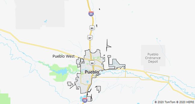
Pueblo
Pueblo, city of Colorado, USA, 70 km south of Colorado Springs; 106,600 residents (2010), of which approximately 44% Hispanics. The city, located on the Arkansas River on the border of the prairie, is the center of an irrigated agricultural region. In addition to the food industry, it has since the early 1900-t. had a significant but declining iron and metal industry from the 1970’s. The University of Southern Colorado is located in Pueblo.
Mesa Verde National Park
Mesa Verde National Park, southwestern Colorado National Park, USA; 211 km2. It was created in 1906 to preserve a large complex of prehistoric rock dwellings that until the 1300-t. was inhabited by the Anasazi people, ancestors of several pueblo tribes. The multi-storey homes are located on a wooded plateau 500 m above the surroundings; i 1200-t. they accommodated a population of approximately 5000 people.
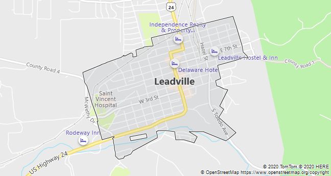
Leadville
Leadville, Colorado, USA, 120 km SW of Denver in the Rocky Mountains; 2688 residents (2010). The city is located 3105 masl and was with the income from a profitable mining in the 1880’s one of Colorado’s largest, richest and liveliest cities. But the wealth lasted short; after a fall in the prices of silver, most mines were abandoned and the city transformed into a ghost town, which has later survived by virtue of tourism.
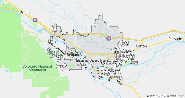
Grand Junction
Grand Junction, town in the Grand Valley at an altitude of 1400 m at Highway 70 in western Colorado, USA; 58,600 residents (2010). Although modest in size, the city is the center of significant irrigated agricultural production in addition to cattle breeding and mining (oil, gas, uranium). Close by are the Colorado National Monument and the Grand Mesa National Forest, which along with the surrounding mountain scenery attract many tourists.
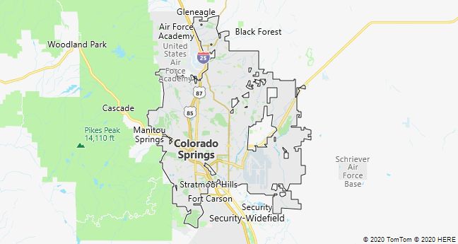
Colorado Springs
Colorado Springs, town at the foot of the Rocky Mountains in the state of Colorado, USA; 416,400 residents (2010), 1800 masl
The nickname “Little Lunnon” (London) alludes to the many Englishmen who moved to the city after the railway magnate WJ Palmer in 1871 founded it as a health resort for tuberculosis patients. At the same time, courses were created for cricket, golf and polo. Especially due to the skiing opportunities, the city has later become an attractive holiday center. Attractions include the Pikes Peak (4200 m), the red-colored rock formations of the Garden of the Gods and the US Olympic Training Camp.
As a home for US Air Force Academy and the headquarters of the North American Air Force Command (NORAD), Colorado Springs is also characterized by large military installations. Since 1970, the city’s population has more than doubled, and the suburban settlement has grown almost explosively.
Boulder
Boulder, town in the Rocky Mountains 50 km NW of Denver in Colorado, USA; 97,400 residents (2010). After the construction of the University of Colorado in 1876, the city has developed into a research center with National Institute of Standards and Technology and National Center for Atmospheric Research; associated with this are many specialized high tech companies. Boulder is located at an altitude of 1600 m; its drinking water comes from a municipally owned glacier 45 km west of the city.
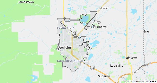
Boulder is known as a liberal city in the otherwise conservative Colorado.
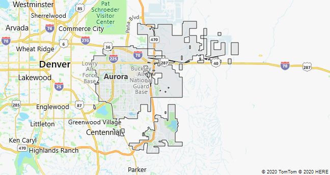
Aurora
Aurora, a suburb of Denver, Colorado, USA; 325,100 residents (2010). It has a past as a mining town (silver finds in the 1890’s), but has since grown large due to its proximity to Denver. In addition to the dominant suburban development, there is a lot of industry as well as the military hospital Fitzsimmons.