Virginia, officially the Commonwealth of Virginia, is a US state in the South Atlantic Ocean region of the United States. It includes parts of the South Atlantic coastal plain, parts of the Piedmont and the southern Appalachians. It was named after Queen Elizabeth I of England and after her first colonial possession, British America. This state is also considered the mother of presidents because eight presidents were born here: George Washington, Thomas Jefferson, James Madison, James Monroe, William Henry Harrison, John Tyler, Zachary Taylor and Woodrow Wilson.
The capital of the Commonwealth is Richmond however Virginia Beach is the most populous city in Virginia.
After more than 150 years as an Anglo-British colony, Virginia became independent with twelve other colonies. In 1788 it became the tenth state in the United States. During the Civil War, the Northwestern counties broke away and became the independent state of West Virginia.
Virginia is located on the east coast of the United States on the Atlantic Ocean roughly midway between northern Maine and southern Florida. The state is bordered by North Carolina and Tennessee to the south, Kentucky and West Virginia to the west, and Maryland and the District of Columbia to the north.
Stretching from the Chesapeake Bay to the heights of the Appalachian Blue Ridge Mountains, the state offers topographical diversity. The Shenandoah National Park, which is well worth seeing, and the highest mountain in Virginia, the 1746 meter high Mount Rogers, are also located here.
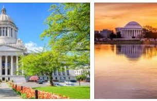
With the neighboring state of Maryland, Virginia shares half of the Federal District of Washington DC, Dulles International Airport and Arlington County.
Climate in Virginia
The climate is shaped by the Blue Ridge Mountains and the Chesapeake Bay. It gets warmer and wetter the further south and east you go. Seasonal extremes from average temperatures of -3°C in January to highs of 30°C in July are among them. Virginia has an annual average of 35 to 45 days of thunderstorm activity and an average annual rainfall of 42 inches. There are an average of seven tornadoes annually in Virginia, most are scaled at F2 or lower on the Fujita scale.
Landmarks in Virginia
One of the most popular attractions in Virginia is Shenandoah National Park in the Blue Ridge Mountains with its densely forested ridges and forests with numerous rivers and waterfalls. There are also three memorials, the Booker T. Washington National Monument, the Fort Monroe National Monument and the George Washington Birthplace National Monument.
UNESCO world heritage
Monticello and University of Virginia at Charlottesville
National Park in Virginia
Shenandoah National Park
Cities and places of interest in Virginia
Richmond
Virginia Beach
Norfolk
Chesapeake
Newport News
Alexandria
Universities & Colleges in Virginia
George Mason University
Virginia Commonwealth University
University of Virginia
College of William & Mary
Old Dominion University
Airports in Virginia
Washington Dulles International Airport / IAD
Ronald Reagan Washington National Airport / DCA
Norfolk International Airport / ORF
Richmond International Airport / RIC
Rivers & Lakes in Virginia
Roanoke River
Potomac River
James River
Rappahanock River
Shenandoah River
Mountain Lake
Lake Drummond
John H. Kerr Reservoir
Virginia mountains
Appalachian Mountains
Mount Rogers
Massanutten Mountains
Cumberland Mountains

Great Falls Park
On an area of 3.65 km2, the small Great Falls National Park stretches along the banks of the Potomac River in Virginia. It is part of Fairfax County and is an integral part of the George Washington Memorial Parkway. Near the northern border of the park, the remains of the Patowmack Canal – the first navigation canal in the United States – are located on the Potomac River. Today, Great Falls Park is protected by the National Park Service.
The park was named after the waterfall it shelters, which is one of the highest waterfalls in the USA – reaching a height of up to 23 meters. During floods, they become gargoyles of huge amounts of water. This area is located just a few kilometers northwest of Washington DC, the Potomac River here forms a natural border between the states of Maryland and Virginia. However, the place is not only famous for its waterfalls, but the local rock areas of Carderock and Great Falls are also sought after.
Climbers will find various climbing possibilities on the rocks around the river, up to a height of 20 meters. On both sides of the river there are gray-white sedimentary rocks. To the north in Maryland, the rocks are less steep than to the south in Virginia – but there are more climbing options there, and the area is also more well-known and famous. Climbers claim that Great Falls Park is one of the best places to climb in the Washington DC metropolitan area
The park is open to visitors all year round, but only during daylight hours. The National Park Service operates a visitor center here. The park has parking spaces for up to 600 cars. Camping is prohibited in the park and there are no campsites.