Louisville
Louisville, (after Louis (Louis) 16.), largest city in Kentucky, USA, separated from neighboring Jeffersonville and New Albany in Indiana by the Ohio River; 597,300 residents (2010). It became grdl. 1778 and was by virtue of river transport an important trading town before industrial growth really set in around World War I. A wide range of industrial products are manufactured here (agricultural machinery, automobiles, synthetic rubber, preserves, etc.), and Louisville is one of the largest producers of cigarettes and whiskey in the United States. Attractions include horse racing and especially the famous Kentucky Derby. 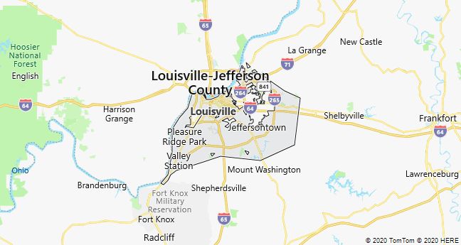
Lexington
Lexington, city of Kentucky, USA, 110 km east of Louisville; 299,800 residents (2010). Nickname: Horse Capital of the World. The city is the economic and cultural center of the Bluegrass region, which with hundreds of studs is world famous for breeding thoroughbred horses. The industry includes electronics and consumer goods, including tobacco (burley) and whiskey (bourbon). Lexington is home to the University of Kentucky.

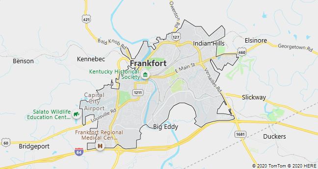
Frankfort
Frankfort, the capital of Kentucky, USA; 27,741 residents (2010). The town, which became grdl. 1786, is located 80 km east of Louisville in the so-called Bluegrass Region. In addition to Kentucky State University and a number of smaller industries, including whiskey distilleries (bourbon), is the center of trade and administration.