Baton Rouge
Baton Rouge, the capital of Louisiana, USA; 229,500 residents, of which 54% are black (2010). The location on the lower course of the Mississippi – in a fertile plains approximately 125 km NW of New Orleans – early made the city a shipping point for cotton, sugar and other plantation products. After the construction of the ocean port and the colossal growth of the oil industry in the 1940’s, the population increased from 35,000 in 1940 to 126,000 in 1950. The oil refineries and the petrochemical industry are located together in the northern part of the city, while the center is characterized by state administration with approximately 55,000 employees. Prominent in the cityscape is the 34-storey parliament building, which was built in 1931-32 under the famous Huey Longs governor’s time. The sights also include the renovated old town of Catfish Town. 
New Orleans
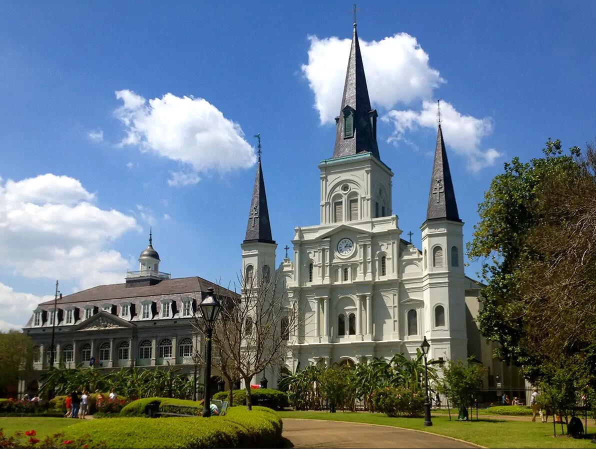
New Orleans, port city of Louisiana, USA on the Mississippi River and Lake Pontchartrain. 343,800 residents (2010). Nickname: The Crescent City.
Since the 1960’s, the city has lost approximately 150,000 residents, of which many whites have moved to the suburbs. Back in the city is a predominance of blacks (60%), who together with a marked influx of cajuns, Creoles and new immigrants from Latin America and Asia form a poor mixed population. approximately 1/4 of the city population has an income below the poverty line.
The city is visited by approximately 7 million tourists a year. The main attraction is the historic quarter Vieux Carré or French Quarter, where picturesque houses with arcades and elaborate wrought iron works form a distinctive mix of French and Spanish architecture from the 1700’s and 1800’s. The cultural diversity is also reflected in the music, mostly jazz, which is the city’s trademark, and in major events such as the Mardi Gras Carnival and The International Jazz and Heritage Festival. The port is among the busiest in the United States, and along the extensive quay facilities that are called at annually by approximately 5000 ocean-going ships, there are numerous oil refineries and petrochemical companies in addition to the aerospace and food industries. By virtue of Tulane University (Grdl. 1834), the city is also a center for medical studies and other higher education.
Until August 2005, the authorities were successful in preventing major disasters; last major flood before then was in 1965. However, it was tricky to limit the discharge of wastewater and chemicals, which led to a serious water pollution.
On August 29, 2005, however, the great catastrophe struck New Orleans. Hurricane Katrina, one of the strongest ever in the Gulf of Mexico, moved inland and hit the city. This time, the dikes burst along three of the city’s canals, and about 80% of the city was flooded. The authorities’ crisis preparedness proved to be extremely deficient. About a million people had left the city by then, but an attempted forced evacuation ended in chaos in several places. In November 2005, the official death toll was set at 1,050 people, but many residents were still missing. The physical injuries amounted to more than 100 billion. dollars, and several observers doubted whether New Orleans would ever fully recover from the disaster. The city’s population fell by almost 30% after the disaster.

History
The city was built by the French in 1718 and already in the 1720’s became an important import port for slaves. After 1763, when New Orleans was ceded to Spain, the British and Americans began to seek refuge there. The city came back into French possession in 1800 and was sold to the United States in 1803 as part of Louisiana (see Louisiana Purchase). It was the capital of Louisiana in 1812-49 and became the largest in the South and the third largest in the United States. It was not only a transhipment site for sailing on the Mississippi River, but also the center of the cotton trade.
Towards the end of the 1800’s. stagnated New Orleans economically, but the petrochemical industry brought new prosperity from the 1920’s.
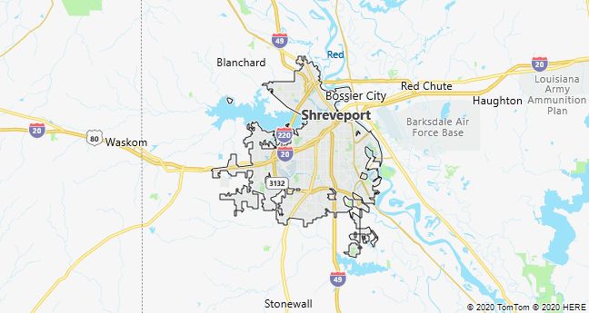
Shreveport
Shreveport, a town on the Red River in Louisiana, USA; 199,300 residents (2010), of which 55% are black. The city, which is a major trade, industry and education center, is located in the Ark-La-Tex three -state region, whose economy is mainly based on oil, gas, cotton and wood. Towards the end of the American Civil War, Shreveport was the capital of the Southern States.