Amarillo
Amarillo, a prairie town in northern Texas, USA; 190,700 residents (2010). Since its founding in 1887, it has been an important supply city and cattle market in The Texas Panhandle area. Since the 1920’s, however, the oil industry has been more important. At a state-owned factory, 90% of the world’s helium production is produced from natural gas. Tourist attractions include rodeo’er and the weekly cattle auctions with annual revenue 1/2 million PCS. cattle. 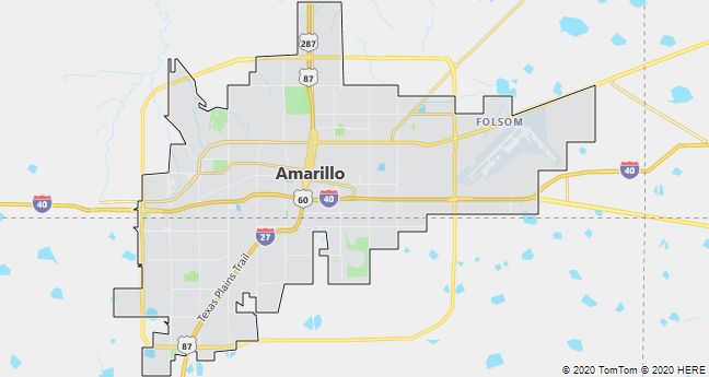
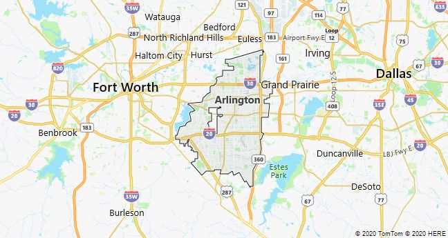
Arlington
Arlington, a city in North Texas, USA; 365,400 residents (2010). With the automotive and aerospace industries as the leaders, it is known for its many industrial establishments and for the Six Flags amusement park across Texas. The city has grown along with the neighboring cities of Fort Worth and Dallas.
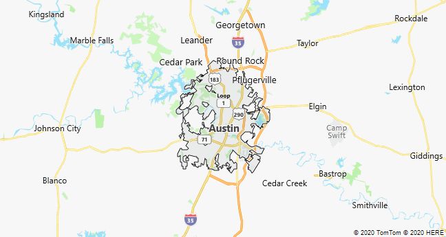
Austin
Austin, the capital of Texas, USA; founded in 1839; 790,200 residents (2010). Unlike other fast-growing American cities, Austin has retained a vibrant city center, where old and new are seen side by side. From the early history of the city there are Victorian and neoclassical houses, several of which have been converted into galleries and museums. The Parliament Building (1888) is listed in pink granite as an almost faithful replica of the Capitol in Washington, DC The prestigious University of Texas(1883) with 50,000 students characterizes the city, which has a vibrant music environment with some of America’s most productive record studios. Austin has attracted many high-tech companies, including by virtue of the university’s recognized department of “computer science”. Inside and outside the city are memorial sites for former United States President Lyndon B. Johnson.
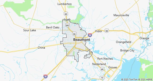
Beaumont
Beaumont, town on the Neches River in South Texas, grdl. 1835, 118,300 residents (2010). Since the completion in 1916 of a 60 km long shipping canal to the Gulf of Mexico, Beaumont has been an important port city with a large export of agricultural products, shellfish and petroleum products. The nickname “The Birthplace of Modern Oil Industry” alludes to a giant oil discovery at the Spindletop field in January 1901, when a huge spill marked the beginning of Texas’ oil adventure.
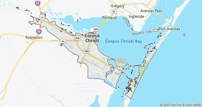
Corpus Christi
Corpus Christi, a port city on the Gulf of Mexico in southern Texas, USA; 305,200 residents, of which 60% of Spanish-speaking descent (2010). Along the coast and on the nearby islands, Mustang Island and Padre Island, there are miles of sandy beaches that, together with a pleasant climate and prevailing onshore winds, have made Corpus Christi attractive to e.g. sailors and surfers.
In addition to tourist income, the economy is based on trade and industry, which really picked up speed after significant oil discoveries (1923) and the construction of a deep-water port (1926). Adjacent to the harbor are large military installations, including the Corpus Christi Naval Air Station (1941).
Dallas
Dallas, a city in northern Texas, USA; 1.2 million population (2010), of which 25% black. Along with Fort Worth, Arlington and other closely connected neighboring towns, it is included in the urban region “Metroplex” with 5.2 million. The economic basis for the city’s rapid growth was created with the oil discoveries in East Texas Field in 1930 and with large military orders (especially aircraft) during and after World War II. The traditional trade sector with agricultural products such as cotton, wheat and beef was from then on surpassed by the industry, which in addition to aircraft and oil products supplies a wide range of goods from computers and high tech products to pharmaceuticals, films and fashion clothing. Most factories are located along highways on the outskirts of the city, especially in the poor and predominantly black neighborhoods to the SW and to the NW in the direction of the great Dallas-Fort Worth International Airport. In contrast to these is Downtown’s numerous modern glass skyscrapers that house offices, banks, insurance companies as well as exclusive hotels and the headquarters of the world’s largest Baptist and Methodist congregations.
At the Dallas Historical Plaza in downtown, a memorial has been erected for President John F. Kennedy, who was shot in Dallas in 1963. In addition, Downtown offers cultural offerings of international format (art collections, theater, ballet, music), but one of the largest tourist destinations of the time is a piece northeast of the city: Southfork Ranch, the characteristic backdrop for the TV series ” Dallas “.

El Paso
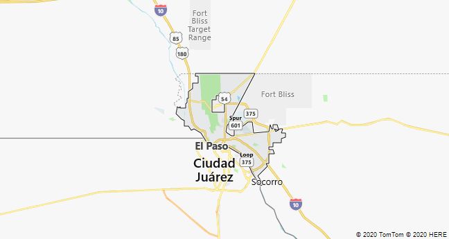
El Paso, a town on the Rio Grande in Texas, USA; by bridges connected to the neighboring city of Ciudad Juárez in Mexico; 649,100 residents, of which 81% of Spanish-Mexican descent (2010). The city is the center of a large catchment area with cotton cultivation, cattle breeding and mining, which has created the basis for a significant processing sector (smelters, refineries, etc.). Since 1965, the majority of labor-intensive production, particularly the textile industry, has moved to Ciudad Juárez. In and around the city are large military installations, including Fort Bliss, which was built to defend against the Apache Indians (1848), but is now the center of the US Army air defense with approximately 20,000 troops stationed.
With its past as a mission station and its close connection to Mexico, Spanish language and culture are the dominant element in the city center, while the fast-growing suburbs are dominated by English-speaking settlers.
Fort Worth
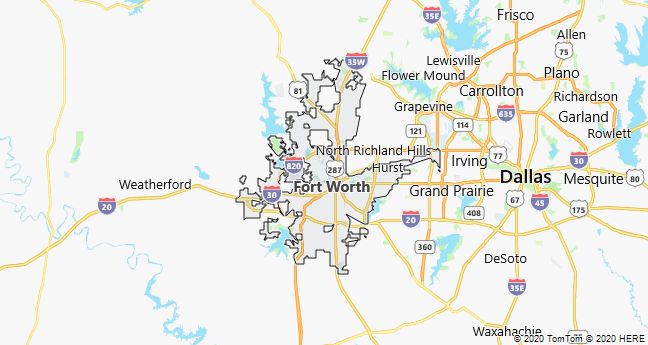
Fort Worth, a city in northern Texas, USA, 50 km west of Dallas; 741,200 residents (2010). The nickname Cowtown USA dates back to the 1870’s, when it was the last stop on the cattle route Chisholm Trail to Kansas. After rail connections in 1876, the city’s famous cattle auctions erupted, while the oil industry shot up after major discoveries in 1920. The rapid growth that has characterized the city since World War II can be attributed to the creation of Carswell Air Force Base and the state-subsidized aerospace industry. such as General Dynamics, Tandy Corporation and Bell Helicopter.
The city ranks among the country’s most coveted and houses relatively many wealthy people. In addition to several colleges, there are a number of reputable museums, including the Amon Carter Museum of Western Art with a unique collection by Frederic Remington and other of America’s most prominent painters of the 1800’s.
Houston
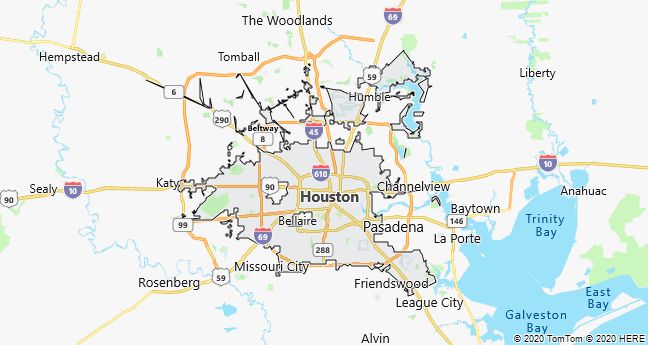
Houston, a port city in southeast Texas, USA; grdl. 1836. The city area is 1320 km2 with 2.1 million residents (2010), of which approximately 24% black and 44% Spanish-speaking. After briefly being the capital of the Republic of Texas (1836-39, 1842-45), it slowly grew as a trading center in the 1800’s. (cotton, cattle and rice), before growth really took off shortly after 1900, when the city had only 45,000 residents. long shipping canal connecting to the Gulf of Mexico(1914). Today, the port is among the largest in the United States, and there is a large concentration of especially oil refineries and petrochemical companies. It therefore caused tremors across the country when the city-based energy company Enron was declared bankrupt in 2001. In Houston, approximately 4000 people their work and pension.
The majority of the many new industries that have emerged since the 1960’s are research-heavy high-tech industries, etc. located in industrial parks along the ring road The Loop and other highways on the outskirts of the city. Many of the new industries are via contracts based on subcontracting to local research centers and universities. The largest of these include the University of Houston, Texas Medical Center, and the world-renowned Lyndon B. Johnson Space Center, created 35 km SE of downtown in 1961. Downtown itself does not take up much space, but stands with its ostentatious office buildings in sharp contrast to the endless coastal plain’s endless suburban neighborhoods. The “Astrodomain” area, in addition to a large exhibition center and a giant amusement park, houses the covered stadium The Astrodome.
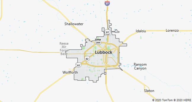
Lubbock
Lubbock, prairie town of the Texas Panhandle of North Texas, USA; 229,600 residents (2010). From its founding in 1890, it has been an important center for cattle and agricultural products (cotton, wheat, alfalfa, sunflower), later also for the oil and gas industry as well as wine production. The city center is characterized by Texas Tech University (approximately 23,000 students), which together with other educational institutions and the nearby military base Reese Air Force Base have contributed to a rapid growth since World War II. In the United States, the city’s name is associated with the rock idol Buddy Holly.
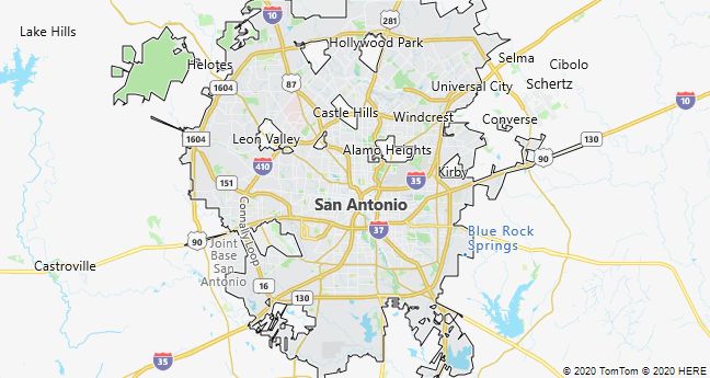
San Antonio
San Antonio, a city in southern Texas; city population 1.3 million population (2010), of which 63% are of Spanish-Mexican descent. The city, which with its colorful downtown is considered one of the most attractive cities in the United States, is both a commercial, tourist and educational center. Economically, it has for many years benefited from military installations and nearby air bases, such as Fort Sam Houston (1879) and Lackland Air Force Base (1941). The growth since the 1970’s is mainly due to the influx of high-tech companies in e.g. Texas Research Park near University of Texas and South Texas Medical Center. Of importance is also the oil and food industry, incl. the Pearl and Lone Star breweries, as well as banking and insurance business.
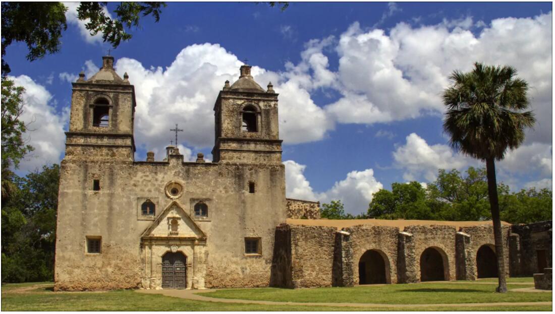
San Antonio is rich in historic buildings, such as the Spanish Governor’s Palace (1749) and the legendary Alamo and other 1700’s mission stations. Among the sights are also the Sea World of Texas and the beautiful Paseo del Rio promenade along the San Antonio River in the center.
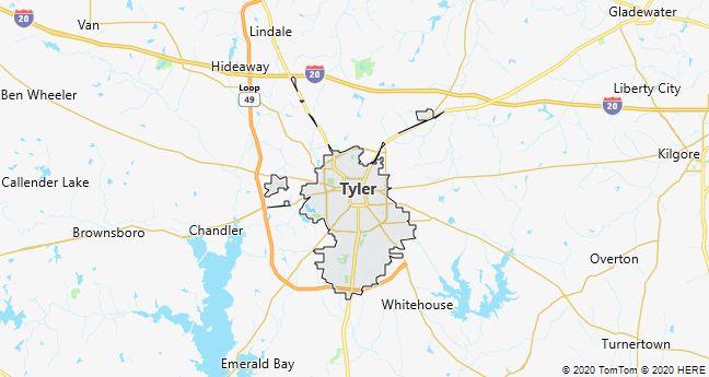
Tyler
Tyler, Texas, USA 160 km east of Dallas; 96,900 residents (2010). Where Tyler was an important agricultural center until the 1930’s, it has since been economically dependent on oil extraction in the East Texas Oilfield. The city is a significant educational site and known for its rose park and many flower gardens.
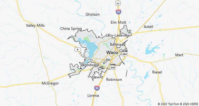
Waco
Waco, a city between Austin and Dallas in Texas, USA; 124,800 residents (2010). The city is a trade, industry and education center with the Christian Baylor University (about 15,000 students).
In 1993, the city became nationally known when the federal police, after a 51-day siege, attacked the headquarters of the religious sect Branch Davidians, which was accused of illegal possession of weapons. The ensuing fire, declared by the authorities to be self-inflicted, cost 75 sect members their lives.
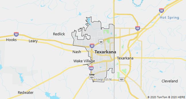
Texarkana
Texarkana, a twin city in Texas and Arkansas, USA, with a total of 143,000 residents in the metropolitan area (2010). The cities, whose administrative boundary is marked by the main street State Line Avenue, are a traffic hub and a small industrial and educational center. Of great importance is the nearby, approximately 130 km2 large Red River Army Depot (1941).
Odessa
Odessa (Texas), a city in western Texas, USA; 99,900 residents (2010). The city is dominated by the oil industry, which shot up after gigantic discoveries in the 1920’s. Close by is the Odessa Meteor Crater, which was formed by the impact of an iron meteorite for approximately 62,000 years ago; the crater is 5 m deep and 168 m in diameter.

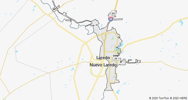
Laredo
Laredo, a city in the United States in southern Texas on the Rio Grande on the border with Mexico. Founded 1755; 236,100 residents (2010), of which 96% of Spanish-Mexican descent. The city belongs to the American Plaza Towns, which according to Spanish building customs are built around a central square. It is the center of an irrigated agricultural district and has a significant oil and gas industry, but is otherwise characterized by tourism and border trade across the bridge to the neighboring town of Nuevo Laredo in Mexico. Laredo was the capital of the Republic of Rio Grande in 1839-41.
Galveston
Galveston, a port city on Galveston Island off the coast of Texas; 47,700 residents (2010). In the late 1800’s. and until the year 1900, when a hurricane killed over 6,000 people and caused great destruction (the most serious natural disaster in human life in the United States so far), it was the largest city in Texas due to the port and rail connection to the mainland from 1856. Remains from the heyday are seen in the center, which is rich in well-preserved historic buildings, several of which are decorated as museums, while others such as the University of Texas Medical Branch have retained their original function. The railway was later closed down and replaced by a motorway, while the port in the 1970’s specialized in shipping bulk goods such as grain, sulfur and cotton and importing, among other things. bananas, tea and gum.
At the harbor there are oil refineries, chemical industry and food companies, while the south coast beaches, separated from the town by a 16 km long dike with the famous Seawall Boulevard, are a popular tourist destination. The city is part of the Houston-Galveston-Brazoria urban region with a total of 5.95 million residents (2010).

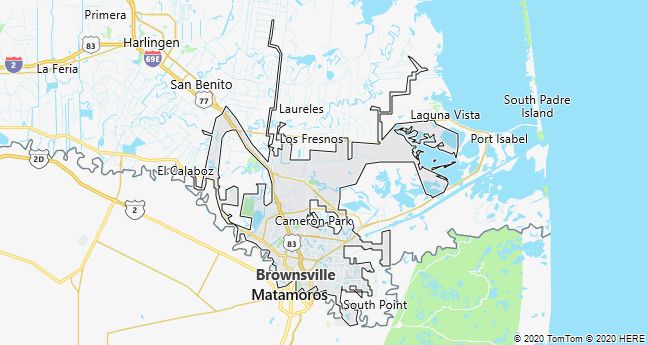
Brownsville
Brownsville, a port city on the Rio Grande in Texas; 175,000 residents (2010). Since the construction of a 30 km long deepwater canal to the Gulf of Mexico in 1936, the city’s development has been linked to the port, but it is otherwise characterized by border trade and shopping trips to Matamoros in Mexico on the other side of the river.
Abilene
Abilene, a prairie town in central Texas, USA; 117,100 residents (2010). Emerged as a railway hub (cattle transport) in 1881. Later, the city was dominated by revenues from oil and natural gas. The Old Abilene Town tourist attraction is a reconstruction of a typical “western town”.