Little Rock
Little Rock, capital and largest city of Arkansas, USA, separated from neighboring North Little Rock by the Arkansas River; 193,500 residents (2010), of which 42% are black. The city is located in the geographical center of the state and is an economic, administrative and cultural center with a diverse industry and higher education institutions, among others. University of Arkansas. 
In 1957, President Eisenhower sent Confederate troops to Little Rock to enforce the 1954 Supreme Court ruling that racial segregation in schools violated the principle of equality. In violation of state rights, Arkansas Governor Orval Eugene Faubus had the National Guard surround Central High School, allegedly to prevent clashes, but effectively to prevent nine young blacks from entering the school. In 1958, after the federal troops had left the city, the local authorities closed the public schools, and only after several trials were they reopened in 1959, and racial integration began.

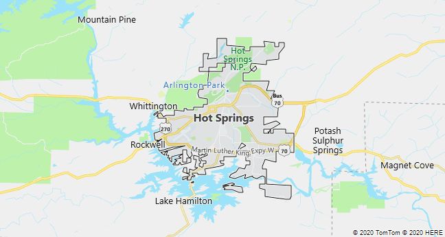
Hot Springs
Hot Springs, Arkansas City, 70 km SW of Little Rock; 35,200 residents (2010). Since the town got a railway connection in 1875, it has been a well-visited health resort due to a large number of heat and reportedly healthy springs. It is located in a beautiful natural area on the east side of the Ouachita Mountains in Hot Springs National Park (1921).