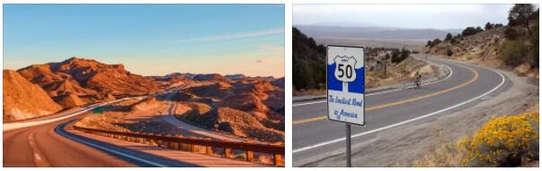
The US state of Nevada is located in the western United States and is surrounded by the states of California, Oregon, Idaho, Utah and Arizona. On October 31, 1864, under President Abraham Lincoln, Nevada became the 36th state of the United States.
With an area of 109,781 square miles, Nevada is the seventh largest state in the United States.
The capital, nicknamed ” The Silver State “, is Carson City with around 55,000 inhabitants (as of 2010). The most populous and tourist-visited city of Las Vegas is the landmark of Nevada. Las Vegas, the gambling city with the largest casinos, has around 583,756 inhabitants (as of 2010).
The highest elevation in Nevada is Boundary Peak in Esmeralda County at 4007 m and the lowest point on the Colorado River in Clark County at 146 m.
The name of the state of Nevada comes from the Spanish word nieve, which means snow. This refers to the snow-capped peaks of the Sierra Nevada mountains.
In southern Nevada between the gambling city of Las Vegas and the town of Tonopah, Nellis Range is a restricted military area that is over 31,000 square kilometers in size.
Nuclear tests above and below ground were conducted at Nellis Range.
The most famous sights of Nevada are the Hoover Dam with Lake Mead and the gambling city of Las Vegas.
National Parks in Nevada
Great Basin National Park
Cities and interesting places in Nevada
Carson City
Black Rock City
Boulder City
Henderson
Las Vegas
Reno
Hoover Dam on Lake Mead in the states of Nevada and Arizona
One of the most famous attractions near the gambling city of Las Vegas is the Hoover Dam. The Hoover Dam is located on the border between the US states of Nevada and Arizona. It is located about 50 kilometers southeast of Las Vegas in Black Canyon. The Hoover Dam dams the Colorado River into impounded Lake Mead. The Hoover Dam was named after the 31st President of the USA – Herbert Clark Hoover. The Colorado River forms the border between Arizona and Nevada.
Lake Mead has an area of 63,900 hectares, a length of about 170 km and a maximum depth of about 180 meters, making it the largest reservoir in the USA.
The purpose of the Hoover Dam is to generate electricity and distribute drinking water to the states of Arizona, Nevada and California. Selling the electricity pays for the maintenance costs of Hoover Dam.
Before the Hover Dam was built, there was regular flooding from snowmelt in the Rocky Mountains and summer droughts from the Colorado River. The Hoover Dam was built in 1920 to regulate the Colorado River.
In 1931 construction of the Hoover Dam began. The dam was built as an arch gravity dam to withstand the enormous pressure of the dammed water. The dam was built from individual 1.5 meter high concrete blocks. Water pipes were cast into the blocks to cool and harden the concrete as quickly as possible. Glass fiber reinforcements were built into the concrete for reinforcement.
The Colorado River was diverted through two tunnels that led through the rock walls of the gorge for the construction period of the Hoover Dam. The tunnels have a diameter of 17 meters and a length of about 1,200 meters.
The Hoover Dam was completed in 1935 after just 46 months. The dam wall is 221 meters high, 379 meters long and 14 – 201 meters thick. The dam consists of approximately 2.6 million cubic meters of concrete and 43,500 tons of steel. The construction of the dam cost around 49 million dollars.
In 1936 the power plant, generators at Hoover Dam Power Station were completed.
The power plant generates more than 4 billion kWh of electricity per year, which meets the annual needs of 1.3 million people and provides 56% power for southern California, 19% for Arizona and 25% for Nevada. The last of the 17 generators went online in 1961.
The four water towers in front of the dam are also interesting. They take the water around 100 meters below the water surface and direct it to the power turbines of the hydroelectric power station.
Almost 100 of the 5,000 workers involved in the construction of the Hoover Dam died as a result of industrial accidents, heat stroke or exhaustion. A total of about 16,000 people worked on the construction of the Hoover Dam. The city of Las Vegas owes its rise to the Hoover Dam workers who settled many workers.
The construction of the Hoover Dam has ecological side effects, and some fish species are threatened with extinction due to the regulation of the Colorado River. Therefore, an artificial flood is generated every few years.
The Arizona-Nevada border runs right through the middle of the Hoover Dam. As a result, the eastern half of the Hoover Dam is in the Mountain Time (Arizona) time zone and the western half is in the Pacific Time (Nevada) time zone. Two clocks on the water towers show the different times. In the summer, however, the times are the same because there is no daylight saving time in Arizona.
Until October 19, 2010, if you wanted to go from Nevada to Arizona, you had to drive straight over the top of the Hoover Dam. On October 19, 2010, after five years of construction, a bridge “Hoover Dam Bypass” parallel to the Hoover Dam was released. Since then you are no longer allowed to drive over the Hoover Dam but have to use this Hoover Dam Bridge.
Stopping is prohibited on both Hoover Dam and the ” Hoover Dam Bypass ” bridge.
The trip to the Hoover Dam is free. Hoover Dam Tours are available at the Visitor Center. Dam tours are $30 per person, and there is a small Hoover Dam Power Plant tour for $11 per person. Admission to the Visitor Center is $8 per person (as of 2012).
Visitor center hours are 9:00 a.m. to 5:00 p.m. The visitor center is open all year except Christmas. Staying on top of the Hoover Dam is prohibited in the evenings and at night for safety reasons.
Address of the Hoover Dam near Las Vegas
Hoover Dam
35 miles from Las Vegas
Boulder City, Nevada
//www.usbr.gov/lc/hooverdam/