Guatemala is located in the north of Central America with borders to Mexico in the west and north, Belize and the Caribbean, Honduras and El Salvador in the east, and the Pacific in the south. Two mountain ranges run through the country from west to east, dividing the country into three natural regions. In the south a narrow coastal plain on the Pacific Ocean, in the north a wooded lowland and between them a fertile highland where most of the population lives.
Topography
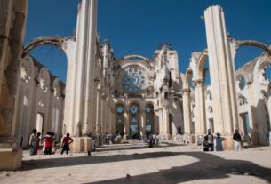
About two-thirds of Guatemala consists of mountains and high plains. Along the Pacific lies a narrow (about 50 kilometers long) coastal plain, the so-called Bocacosta (‘mouth to the coast’). Inside is a volcanic mountain range, Sierra Madre, with 37 volcanoes, eight of which are active. The highest reaches Tajumulco with its 4220 meters above sea level, Central America’s highest point. The volcanic range is part of the so-called ” fire ring ” around the Pacific, formed where the Pacific plate abuts the Caribbean tectonic plate. The unstable geology also causes frequent earthquakes in the highlands, most recently in 1976 when 25,000 people perished.
Within the Sierra Madre, several mountain ranges run across the country, highest reaching Cuchumatanes in the north with peaks over 3000 meters and Sierra de las Minas in the middle of the country with altitudes of around 2000 meters. Between the mountains there are several very fertile plains, but for the most part the terrain is very hilly until the highlands fall steeply down to the lowlands in the north. The last third of the country, the province of Petén in the north, is a flat limestone plateau that extends further north and includes the Yucatán Peninsula in Mexico. The pate is Guatemala’s thinnest populated area.
Climate
With prevailing winds coming in from both seas, most of the country receives plenty of rainfall. The annual average for the whole country is 1320 millimeters of rain and snow can rise at altitudes above 3500 meters in winter. At the same time, Guatemala lies in the hurricane belt and is also exposed to the climate fluctuations caused by El Niño. Hurricanes Mitch (1998) and Stan (2002) demanded thousands of human lives as the huge amount of water triggered large landslides in steep terrain. In recent decades, climate change has led to more frequent extreme weather and at the same time the population has spread into vulnerable areas.
In the far south, where the mountains rise towards the highlands of Alta Verapaz, it rains up to 4000 millimeters a year. North to Yucatán, the annual rainfall drops to 400 millimeters. The northern parts of Petén, which was densely cultivated 1000 years back in time when classical Mayan culture reached its peak, is a type of tropical forest with seasonal rainy season.
Hydrography
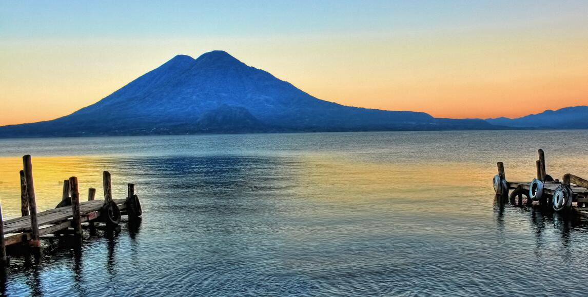
Given the volcanic geology and the steep terrain, the rivers in the highlands are brisk and short and the lakes are confined to small lagoons. The exception is the 130-square-kilometer Atitlán Lake (without drain) that fills a caldera where a large volcano imploded 84,000 years ago. Surrounded by three volcanoes and 1000 meters high wooded mountain walls, the sea is considered one of the most beautiful places on earth.
North and east from the highlands flow the country’s longest and largest rivers. Most watery is Usumacinta (named Chixoy in its upper race) which forms the border between Petén and Mexico and flows into the Gulf of Mexico. The longest is Motagua (486 kilometers), which has an outlet in the Caribbean, between the borders of Belize and Honduras. On the Caribbean side is also the country’s largest lake, Lago Izabal (590 square kilometers), in a wide recess drained by Río Dulce. Here are freshwater shark and cows (manatees).
Agriculture and plant life
With volcanic, good soil, dramatic elevation differences and its subtropical location, Guatemala has an exceptionally high biodiversity. Annual average temperature is 15 degrees in the highlands and 28 degrees on the coasts. About 12 per cent of the land is cultivated land, about 24 per cent is pasture land while forest covers 34 per cent.
Especially in Petén in the north and on the slopes up against the province of Alta Verapaz, the forest is under pressure. From the 1950s onwards, the authorities encouraged new cultivation in the southern and central Petén and here also came thousands of landless Salvadoran migrants. After the year 2000, pressure on the rest of Petén has intensified strongly in connection with the planting of palm oil plantations and intensive harvesting of tropical forest. Combined with a drier and warmer climate, this has resulted in more frequent and larger forest fires.
In the highlands small farms dominate, where corn and beans as well as fruits and vegetables are the most important crops. Coffee, which has long been Guatemala’s most important export product, is grown substantially on larger goods on the slopes between high and lowlands where the temperature is favorable. The coastal plain along the Pacific Ocean is dominated by large estates with pasture land and sugar cultivation.
Along with southern Mexico, Guatemala is the origin of a variety of crops such as corn, cotton, cocoa, beans, chilli, vanilla, tomato, squash and avocado.